Available Now · iOS
UNTRACKD
GPS activity tracking for skiing, hiking, and biking. Record every run, every ridge, every ride.
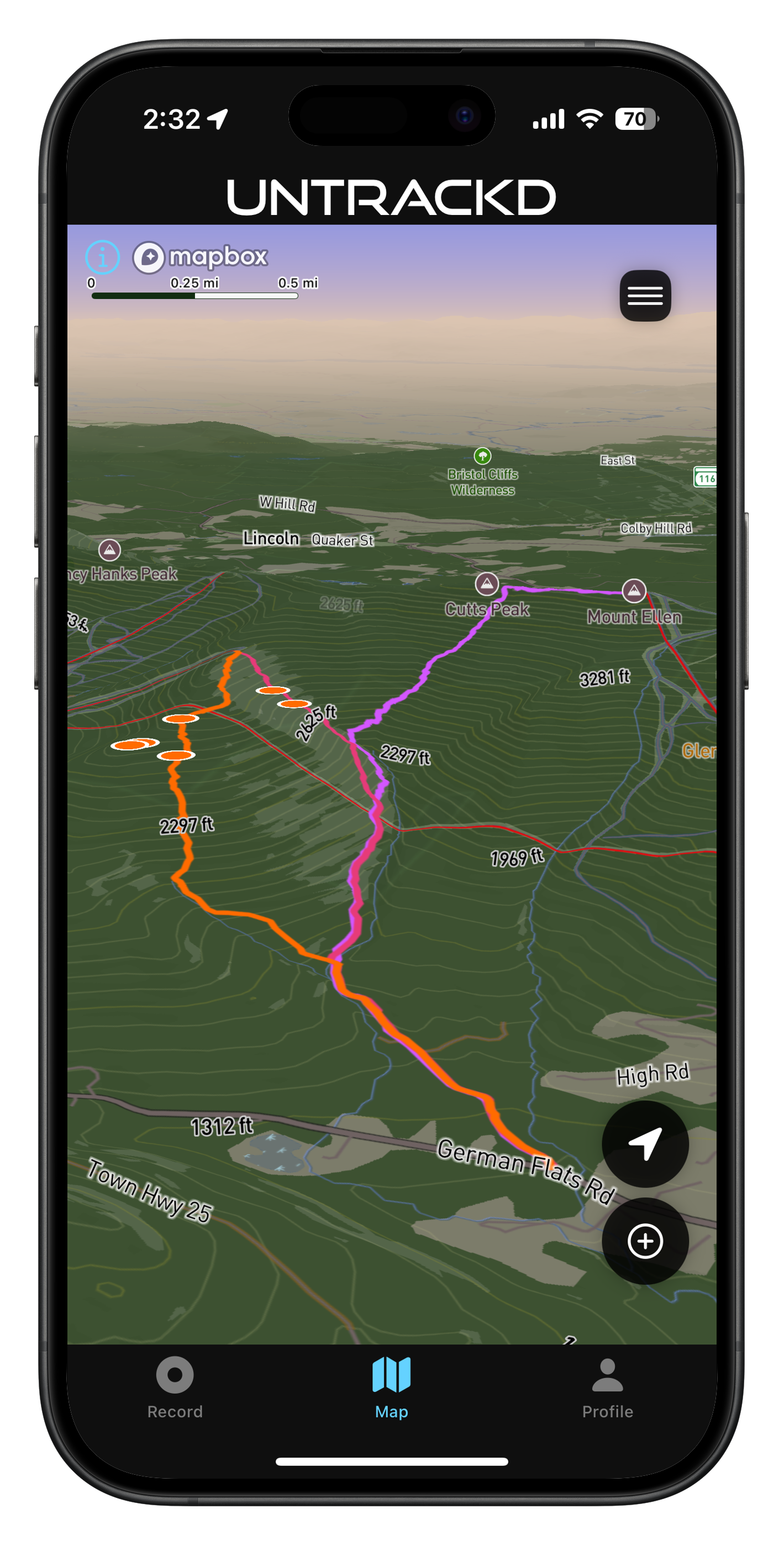
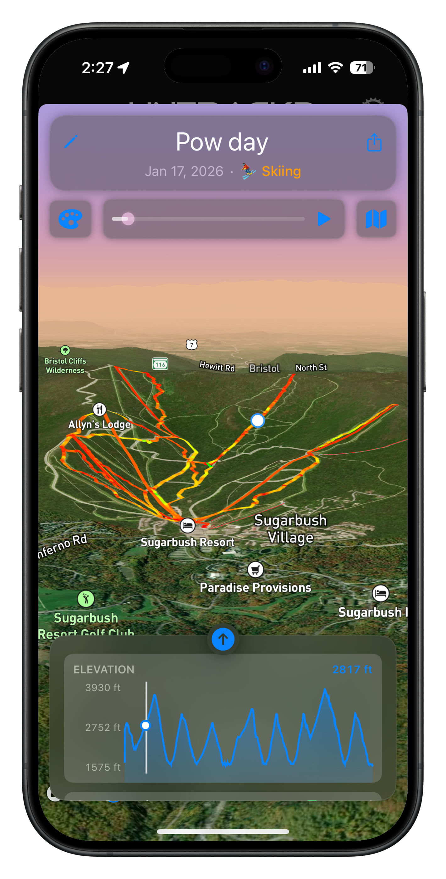
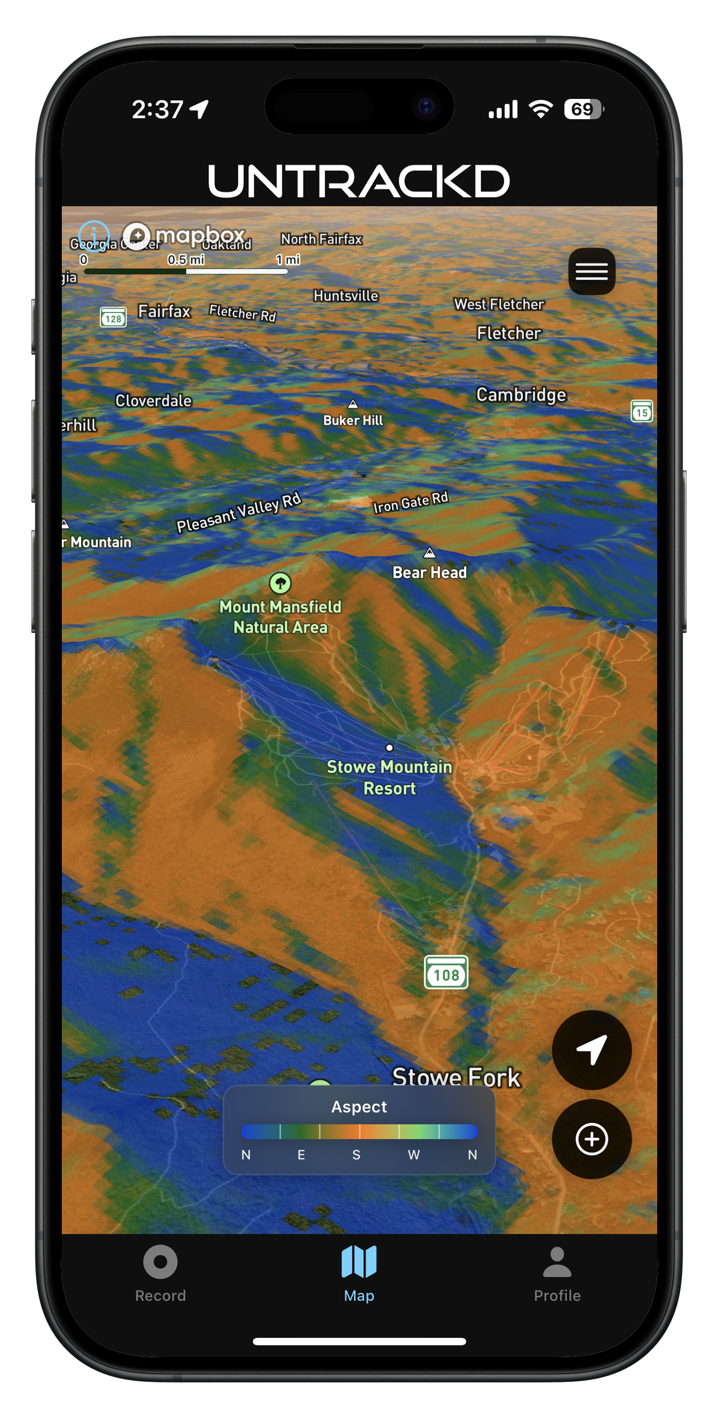
3D Interactive Map
See the mountain like never before
Slope angle heatmaps, aspect overlays, live radar, and your recorded tracks — all on a fully 3D terrain map.
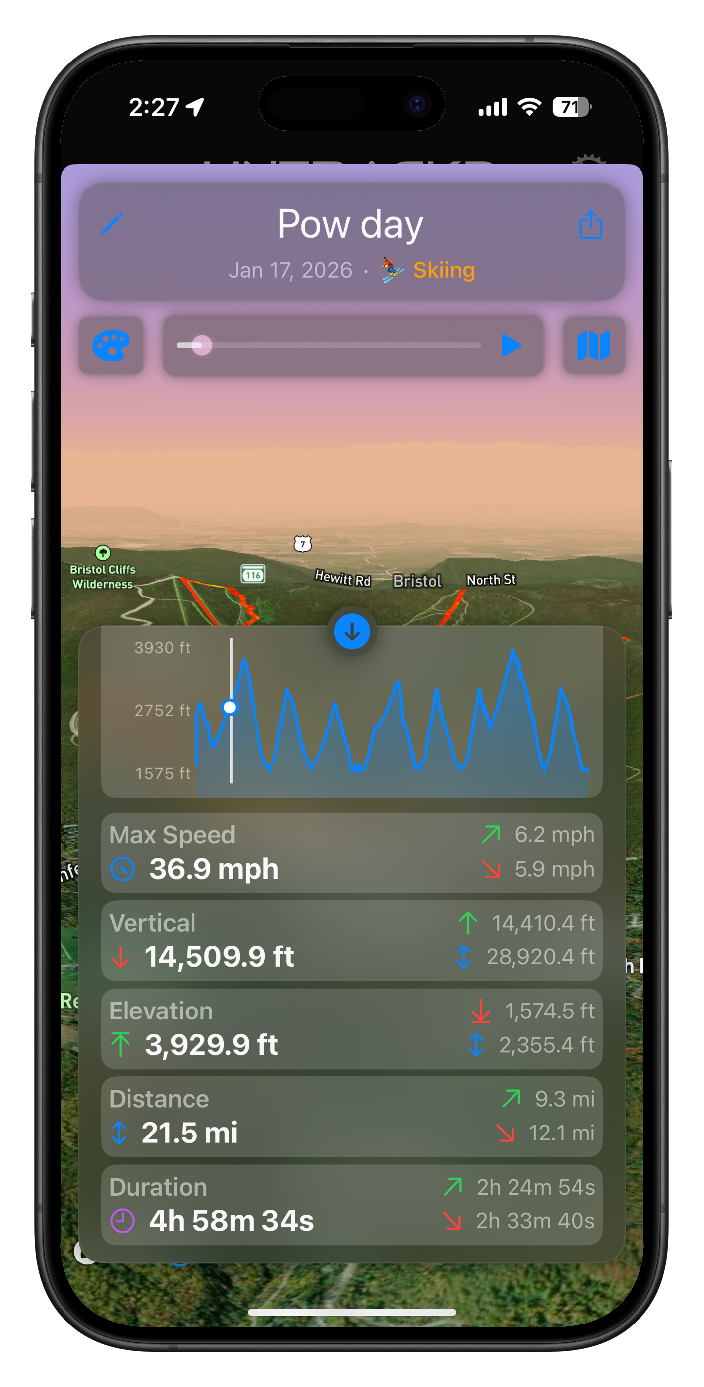
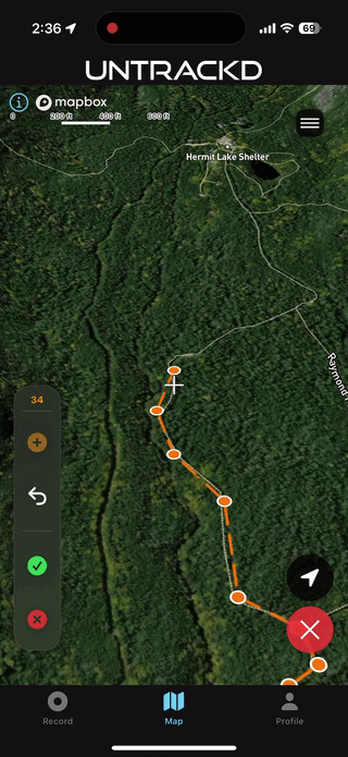
Track Playback
Relive every moment
Animated playback with speed heatmaps, elevation profiles, and detailed split stats for every run.
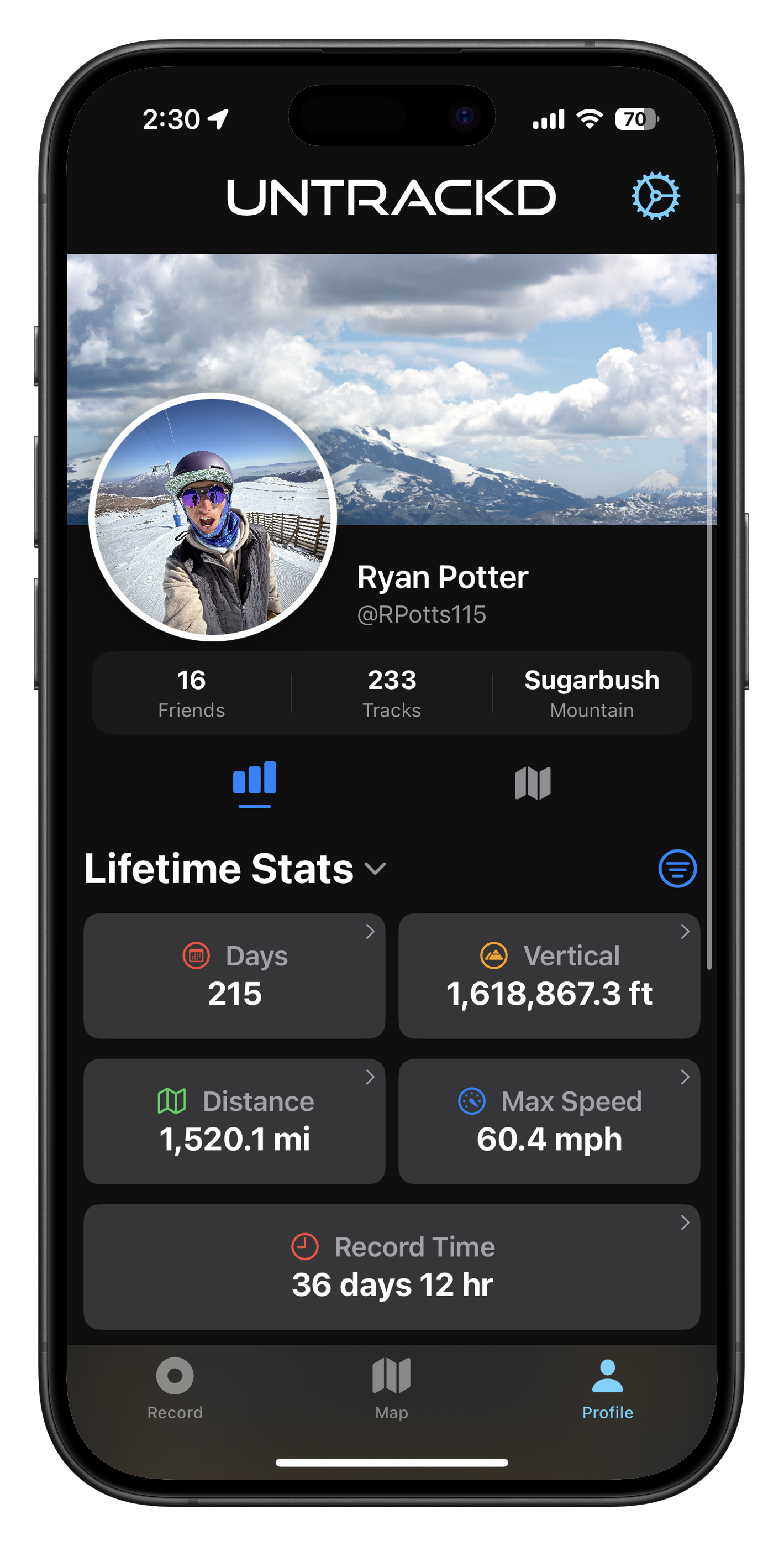
Performance Stats
Your lifetime on the mountain
Lifetime vertical, top speed, total distance, days on snow — all computed precisely from your GPS tracks.
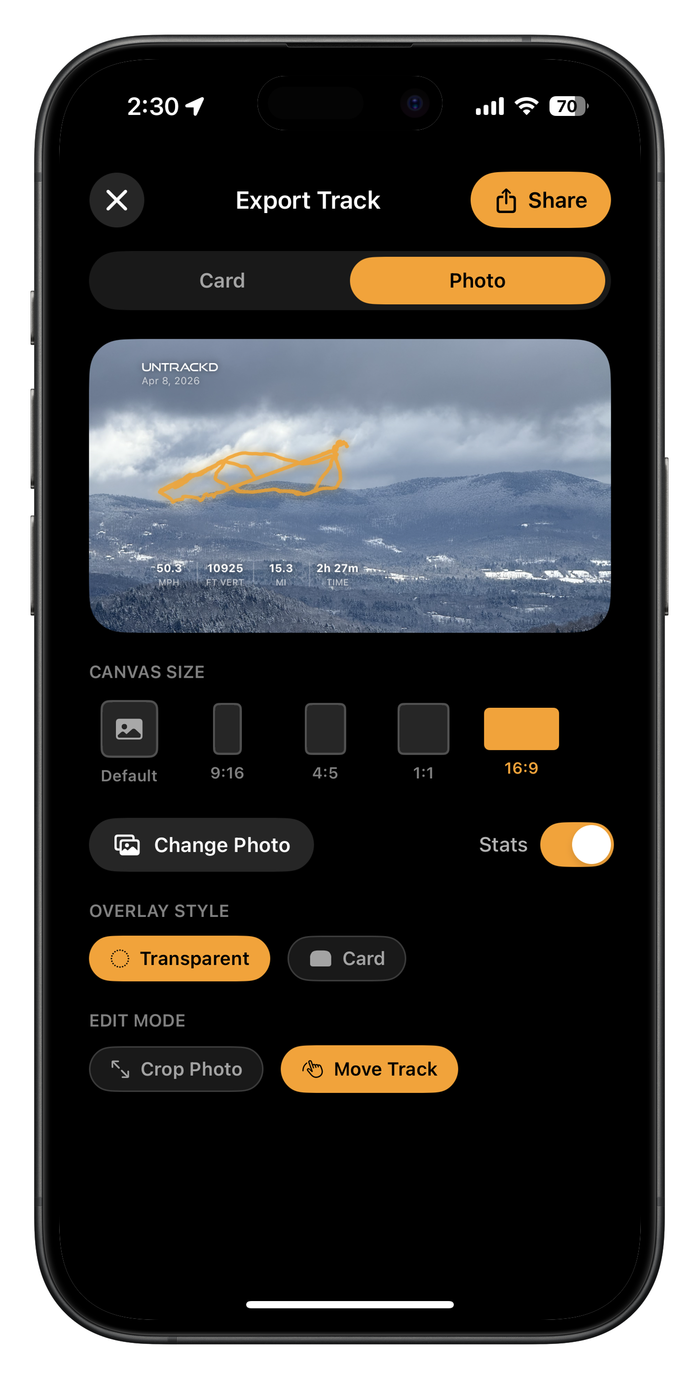
Track Export
Share your adventure
Drop your track over a photo backdrop. Export as a card or story for Instagram, with your key stats built right in.
In Action
See it move
Real features, real tracks, real mountains.
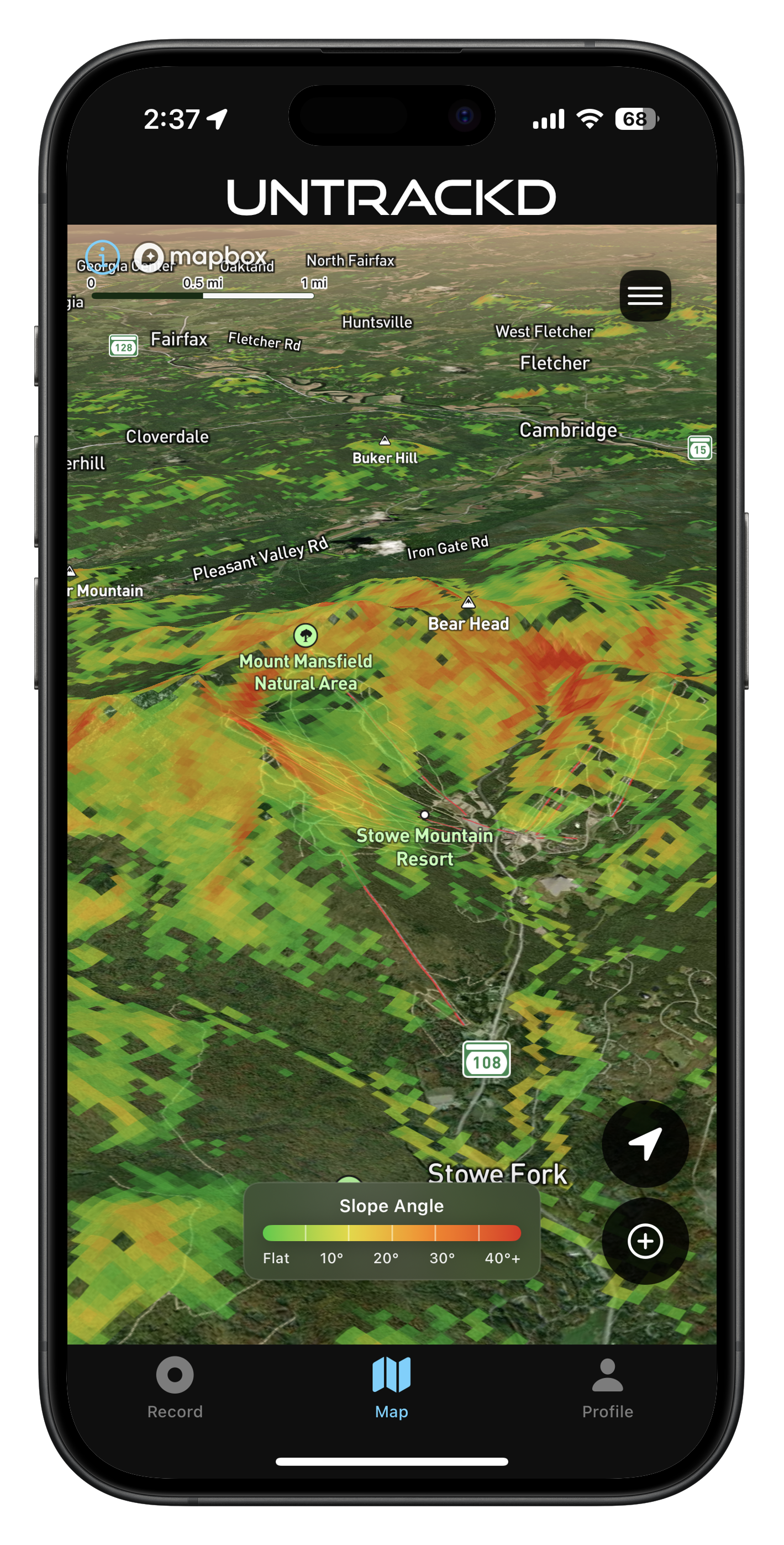
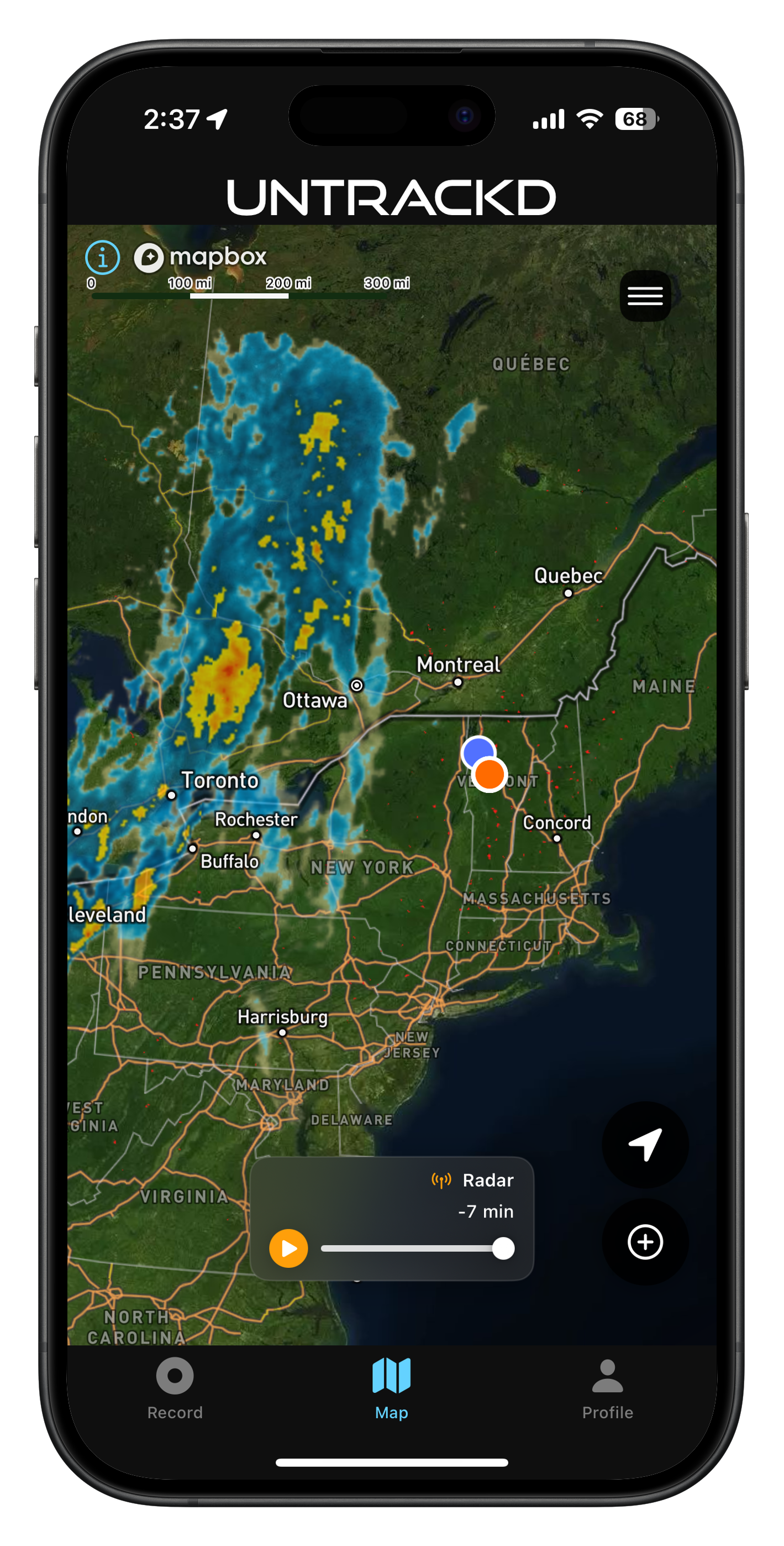
Map Overlays
Know your terrain
Layer weather, slope angle, and aspect data over a full 3D satellite map.
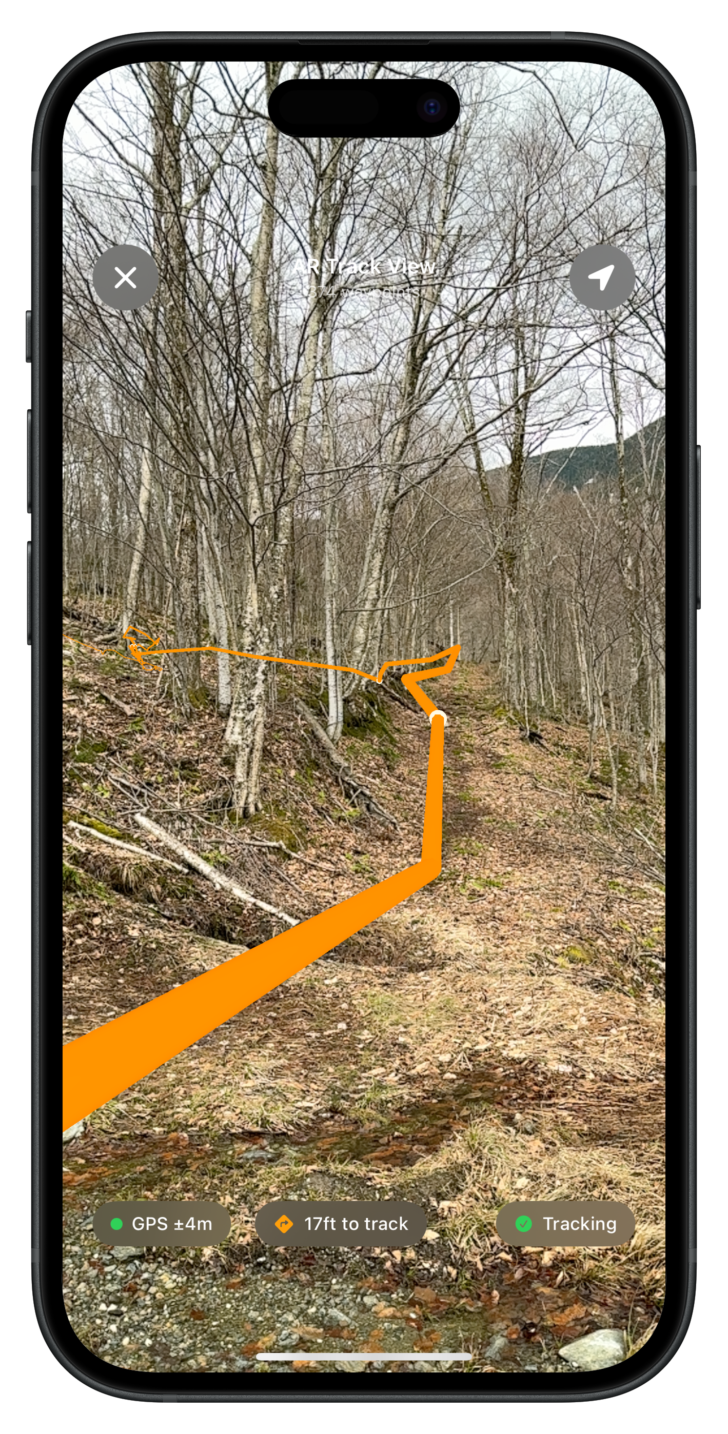
AR Track View
Navigate the trail in AR
Point your camera at the trail and see your saved route overlaid in augmented reality — GPS-anchored to the real world.
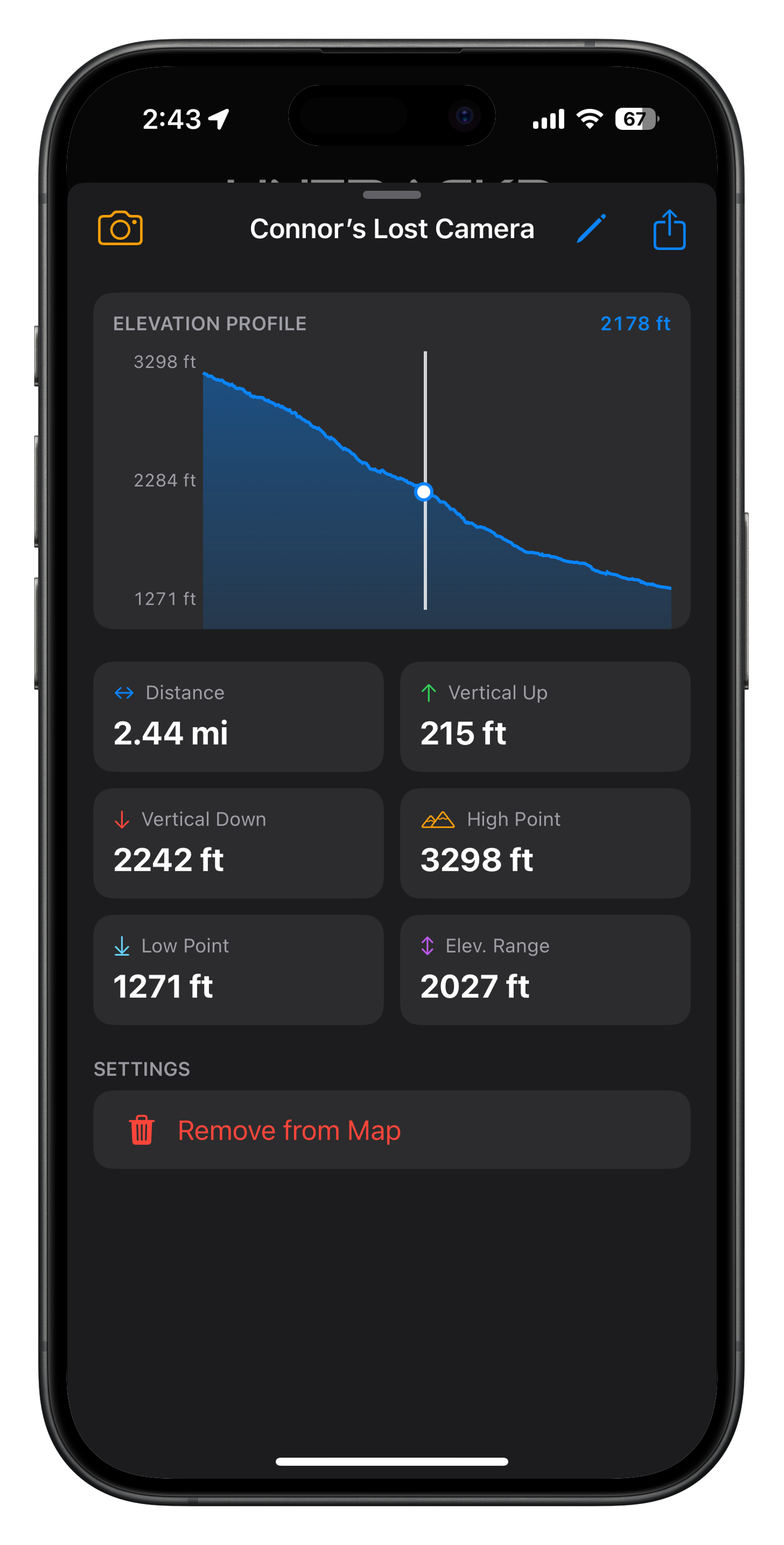
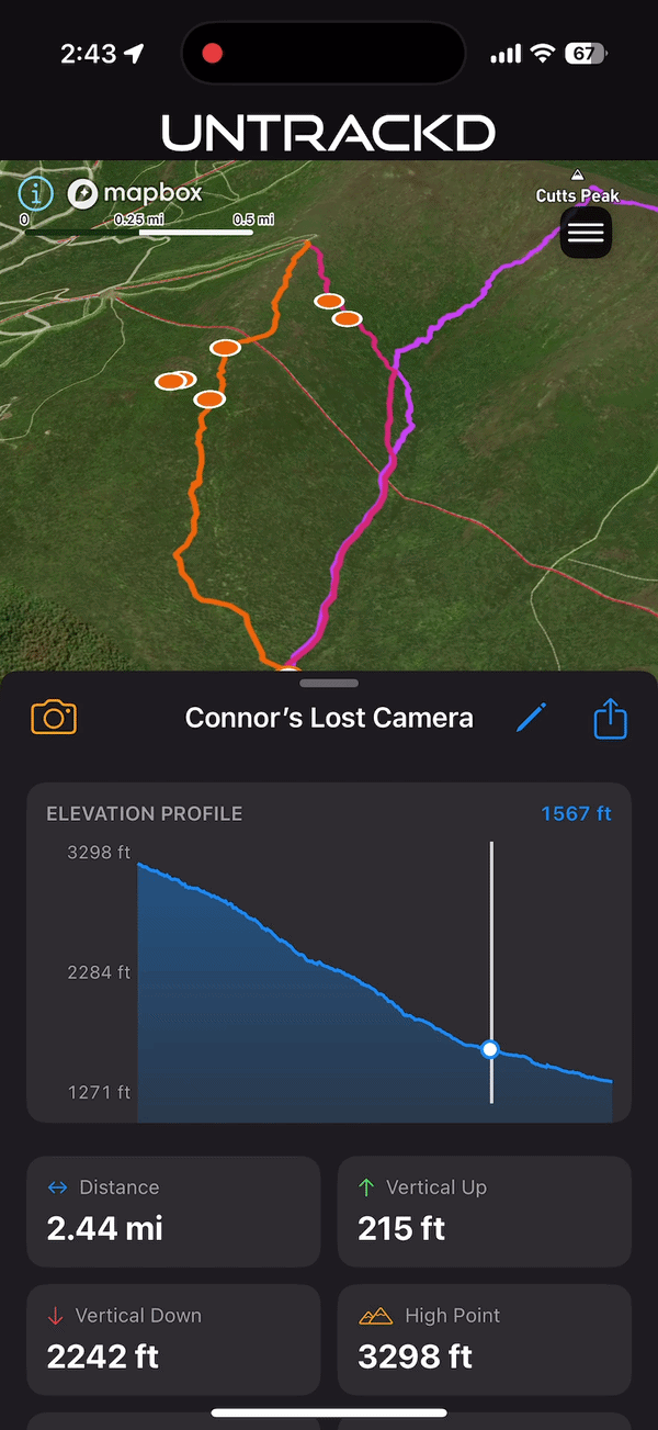
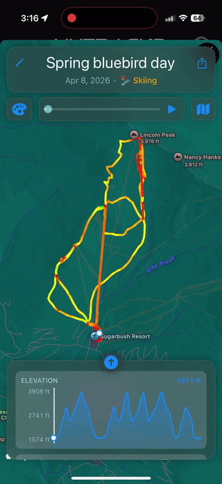
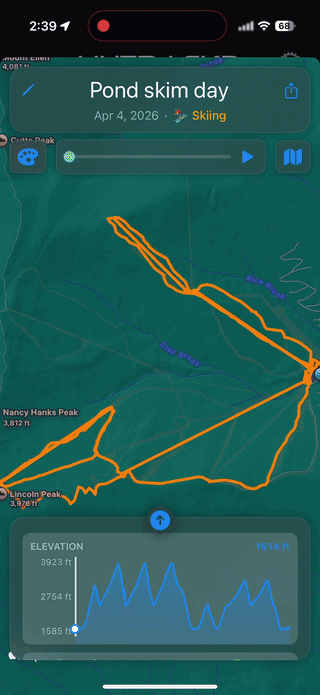
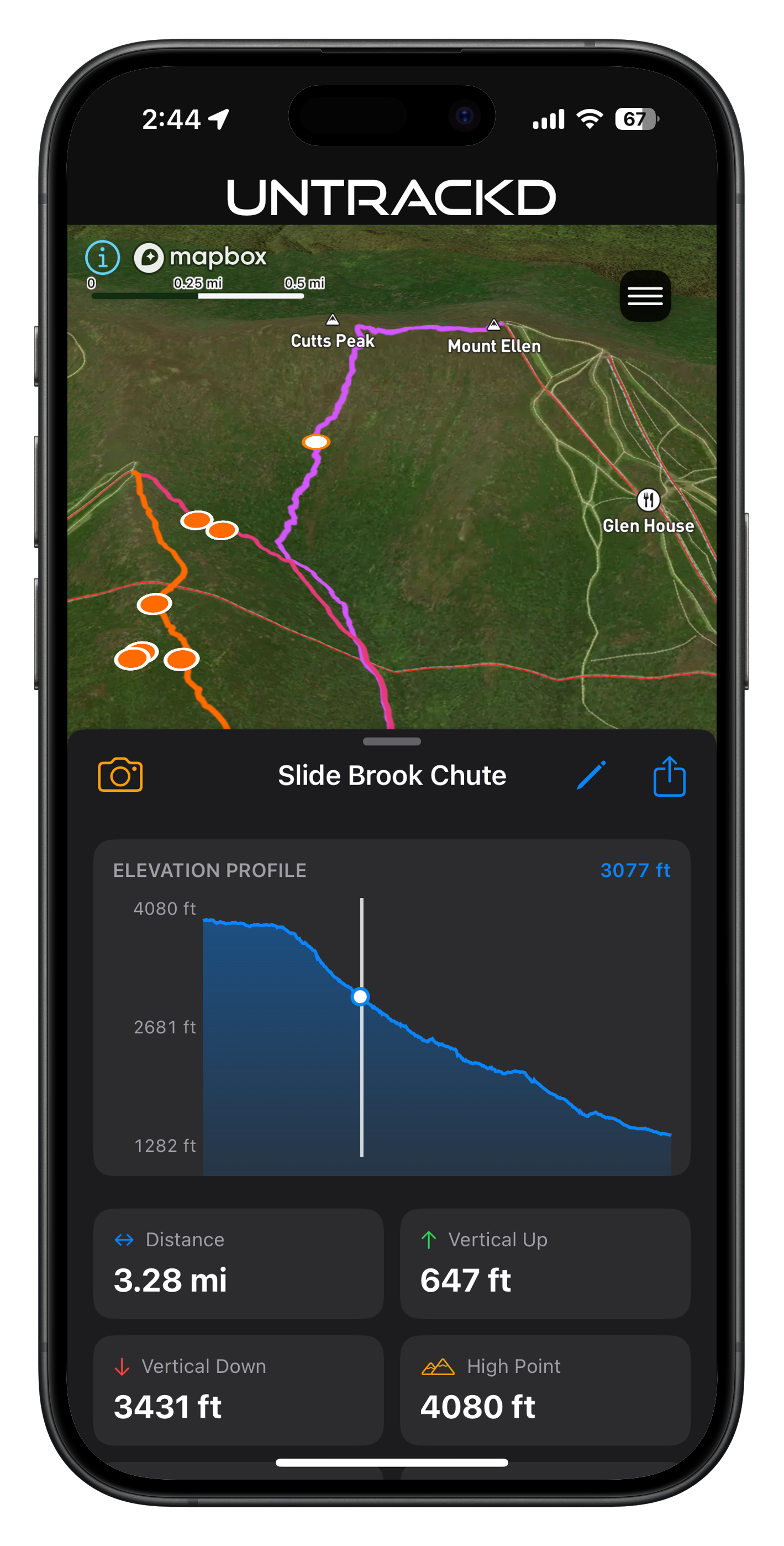
Route Inspector
Deep dive into any route
Tap any saved route for a full breakdown — elevation profile, distance, vertical, and high point. Scrub the chart to explore.
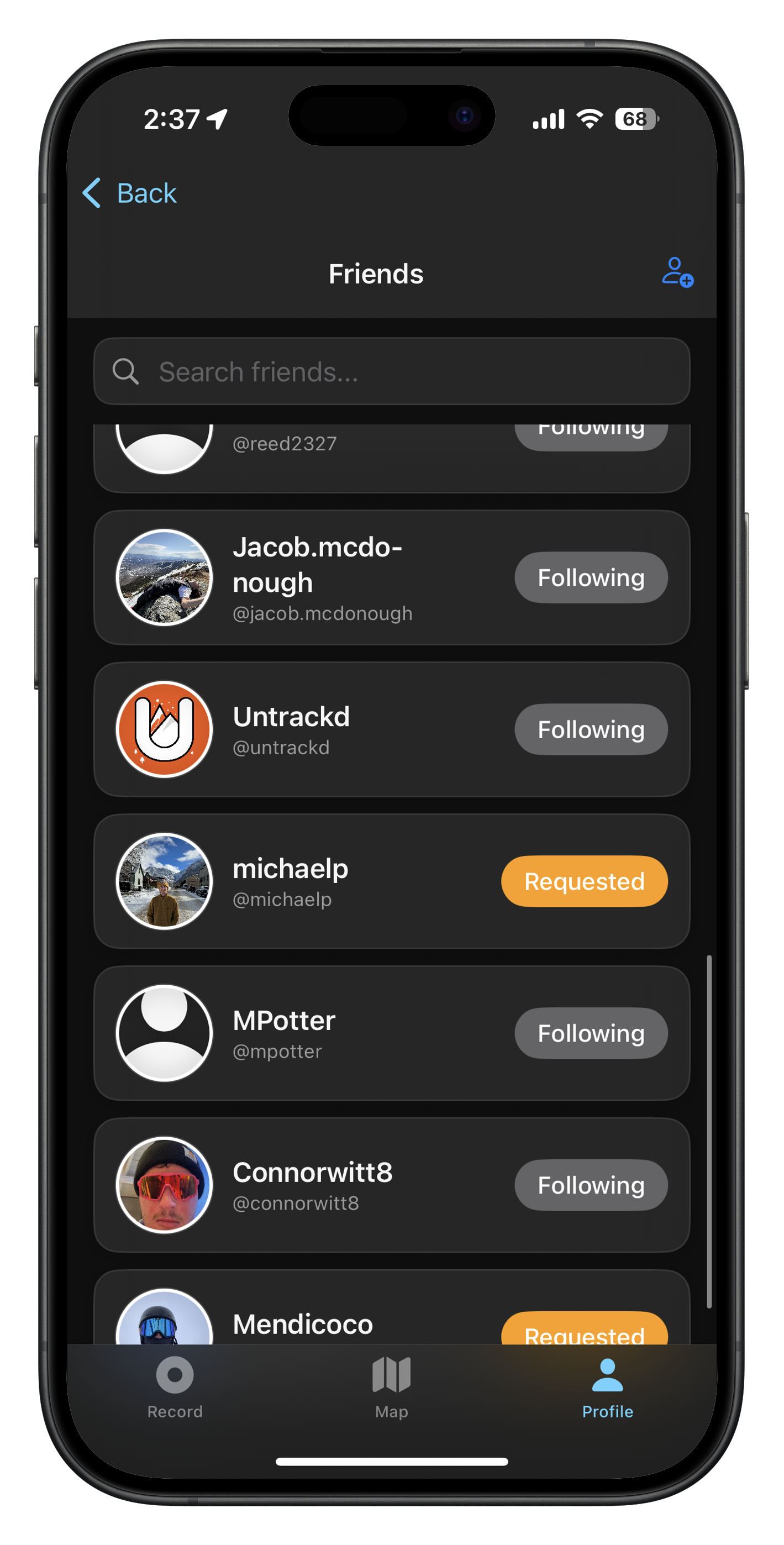
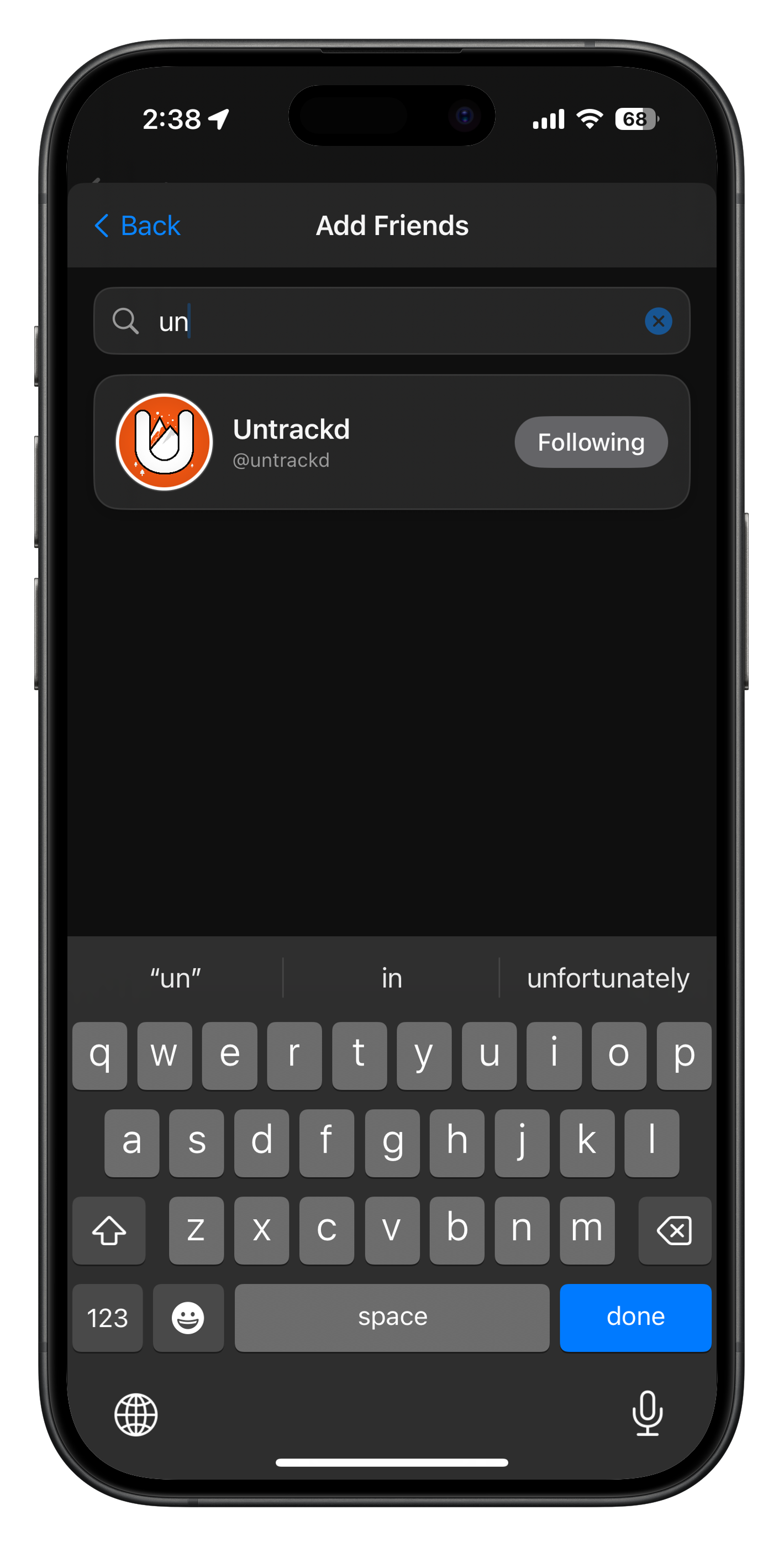
Social
Adventure with friends
Follow friends, compare stats, and see their tracks. Your crew's adventures, all in one place.
GET
OUT
THERE
Untrackd is available now on the App Store. Download free and start tracking your next adventure.
Free · iOS · Active development